A look at how data, locating, and mapping are redefining HDD in North America
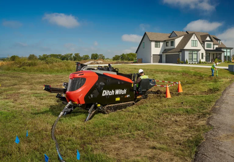
Across North America, horizontal directional drilling (HDD) has become the backbone of modern underground construction. From expanding fibre networks and renewable energy corridors to replacing aging water and gas infrastructure, directional drilling enables contractors to install critical assets with minimal surface disruption. However, as demand rises and underground congestion increases, the margin for error continues to shrink.
HDD contractors today face a tougher underground environment and higher standards for safety, accuracy and documentation than ever before. A single unmarked or inaccurately mapped utility can halt production, damage critical infrastructure and expose crews and companies to significant risk.
In response, the North American drilling industry is shifting. Success is no longer defined by drilling skill or equipment power alone, but by how effectively contractors locate existing utilities, capture accurate data and integrate it into digital mapping systems. Precision locating, GIS-based records and real-time drilling data are now essential tools for HDD success.
Rising expectations beneath the surface
Legislation is rapidly turning underground construction documentation from a “nice to have” into a requirement. California’s SB 865, for example, requires all new underground installations to be mapped with GIS and preserved as permanent records. It also mandates prompt reporting of utility damage to regional notification centres, which must escalate those reports to the Dig Safe Board within strict timeframes.
HDD operators can expect similar requirements to extend across other states and municipalities. Bid specifications are increasingly calling for electronic drilling records, pushing contractors to capture bore data digitally rather than relying on handwritten logs. That means it is no longer enough to simply drill a straight line, contractors must also prove it with reliable, verifiable data.
From marked lines to digital truth
Traditional paint marks and paper plans have long guided HDD crews, but they were never designed for the complexity of today’s projects. Modern best practices now emphasise digitally captured utility locations tied to GPS coordinates, ensuring accuracy that extends well beyond a single jobsite. By replacing temporary markings with permanent digital records, contractors reduce rework, disputes and uncertainty on future projects.
Today’s utility locating relies on technology that integrates electromagnetic detection with GPS and GIS systems. Contractors can capture the precise position of buried assets with sub-metre or even centimetre-level accuracy. Instead of leaving behind paint that fades or notes that get lost, they can now produce digital maps that are detailed, time-stamped and easy to share.
This shift is more than just an upgrade in tools; it represents a fundamental change in how information is collected, verified and preserved. Real-time data can be uploaded directly into GIS platforms such as Esri, creating permanent digital records accessible to contractors, utility owners and regulators alike. This unified approach reduces conflicts and enhances coordination across every phase of the project.
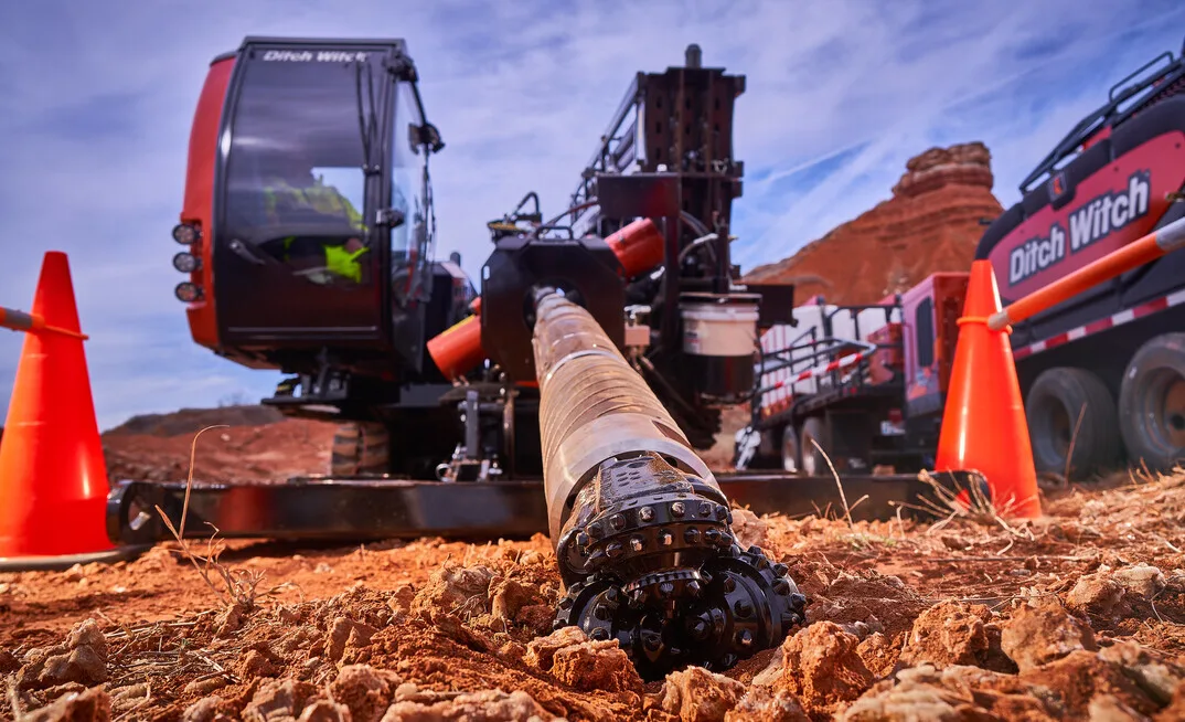
Ground-penetrating radar: a critical planning tool
Ground-penetrating radar (GPR) has become an increasingly valuable asset for North American HDD contractors, particularly in areas with non-metallic utilities or incomplete records. Modern GPR systems like Subsite’s GeoRanger XR Series use dual-frequency antennas to identify both shallow and deep utilities in a single pass. Add GPS integration, and suddenly an operator can walk a jobsite, watch a digital map light up with buried lines, and know exactly where to drill.
This kind of precision used to be science fiction; now it’s expected. Contractors can upload maps, layer them in Google Earth, and generate visual reports that show every pipe, cable, and conduit in its exact location. Crews are not flustered and fumbling in the dark. They are navigating with a spotlight to guide the way.
And because the latest GPR units are ruggedised with adjustable carts and multi-position antennas, they can handle jobsites from downtown to rocky hillsides. If there is a buried obstacle, chances are it can be seen, logged, and avoided.
Data-driven drilling as best practice
Telematics has become an increasingly important tool in underground construction, helping directional drilling contractors turn machine activity into usable jobsite data. Modern HDD operations generate valuable information throughout the drilling process, including bore depth, pitch, roll, fuel use and machine performance. Telematics systems organise this data in real-time, creating accurate records that support safer operations, better decision-making, and clearer accountability.
As documentation requirements continue to expand across North America, telematics is also playing a key role in compliance. In highly regulated regions such as California and parts of Europe, electronic drilling records are already required, and similar expectations are appearing in bid specifications elsewhere. By capturing drilling data automatically and timestamping it to specific locations, telematics reduces reliance on manual logs while improving accuracy and consistency.
Newer telematics platforms are focusing on clarity rather than volume of information. Systems such as Ditch Witch’s Orange Intel platform allow contractors to customise dashboards based on their role and priorities, helping fleet managers, owners and operators focus on productivity, maintenance and regulatory needs without unnecessary data overload. As the industry continues to shift toward digital documentation and data-driven work, telematics is becoming a standard part of best practices for modern directional drilling operations.
Technology built for the jobsite
The shift toward digital locating, mapping and drilling data is driven by field experience, not theory. Contractors have pushed for tools that work in real-world conditions and reduce the administrative burden that often follows a long day on the job. In response, modern locating and mapping systems now allow crews to capture accurate subsurface information directly in the field and move it into GIS platforms without manual data transfers.
At the same time, today’s HDD rigs are increasingly equipped to generate digital drilling records automatically. Telematics systems can store bore data and machine performance information in real time, eliminating the need for handwritten logs and after-hours reporting. Platforms such as Ditch Witch’s Orange Intel system allow operators and managers to securely archive this information and access it later for documentation, analysis or compliance review.
These tools are not designed as add-ons, but as practical solutions for the crews installing critical infrastructure every day. By saving time, improving accuracy and simplifying recordkeeping, modern locating, mapping and telematics technologies are helping contractors work more efficiently while navigating an increasingly regulated underground construction environment.
The new standard for HDD
Directional drilling in North America is entering a new era, defined not just by production speed or equipment capability, but by accuracy, accountability and trust. As infrastructure corridors become increasingly congested and regulatory scrutiny intensifies, the industry is shifting away from assumptions and toward verifiable, data-driven execution.
Precision locating, documented bore paths and integrated mapping are no longer emerging practices, they are becoming the baseline for responsible work.
Contractors who adopt a connected approach to underground construction place themselves ahead of that curve. When locating, drilling and mapping function as a single system, crews gain clarity before the bore begins, control while it is underway and confidence long after it is complete. Digital records protect contractors, support compliance and create lasting value for utility owners and municipalities alike.
In an industry where unseen risks carry real consequences, success depends on eliminating uncertainty wherever possible. The future of directional drilling belongs to those who locate with confidence, drill with data and leave behind accurate, permanent records that strengthen the underground network for everyone who builds on it next.